“Where you at?” workshop
Where you at? was a workshop on making and thinking with maps that was held on Friday March 22, 2014 in the Morris library at Southern Illinois University Carbondale. The walls were covered with a collection of maps resourced from the library GIS area and a text written by Nick Smaligo and I that offered observations on the instrumental power of cartography.

workshop, “Where you at?” on mapping at Morris Library,SIUC Carbondale, IL
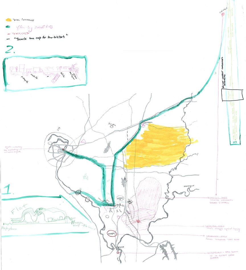
For our workshop, Amy Partridge, Rozalinda Borcila & Matthias Regan prepared a presentation and a base map with help from Ryan Griffis. The goal of the workshop was to gather attention around commonsense cartographies—maps we carry around in our heads; those places or scenarios we think we know. We were interested in where our knowledge collects, and where it draws a blank—the zones that remain empty when we attempt to map what we know personally. There was an expectation this strategy might frame the drifts to be taken on Saturday and Sunday, filling in new information.
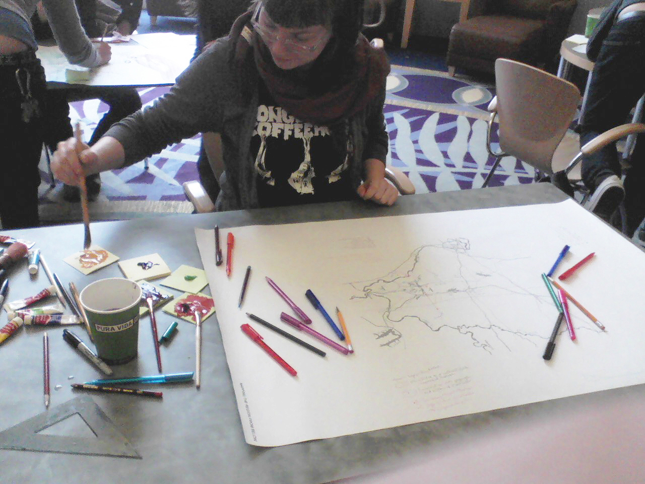
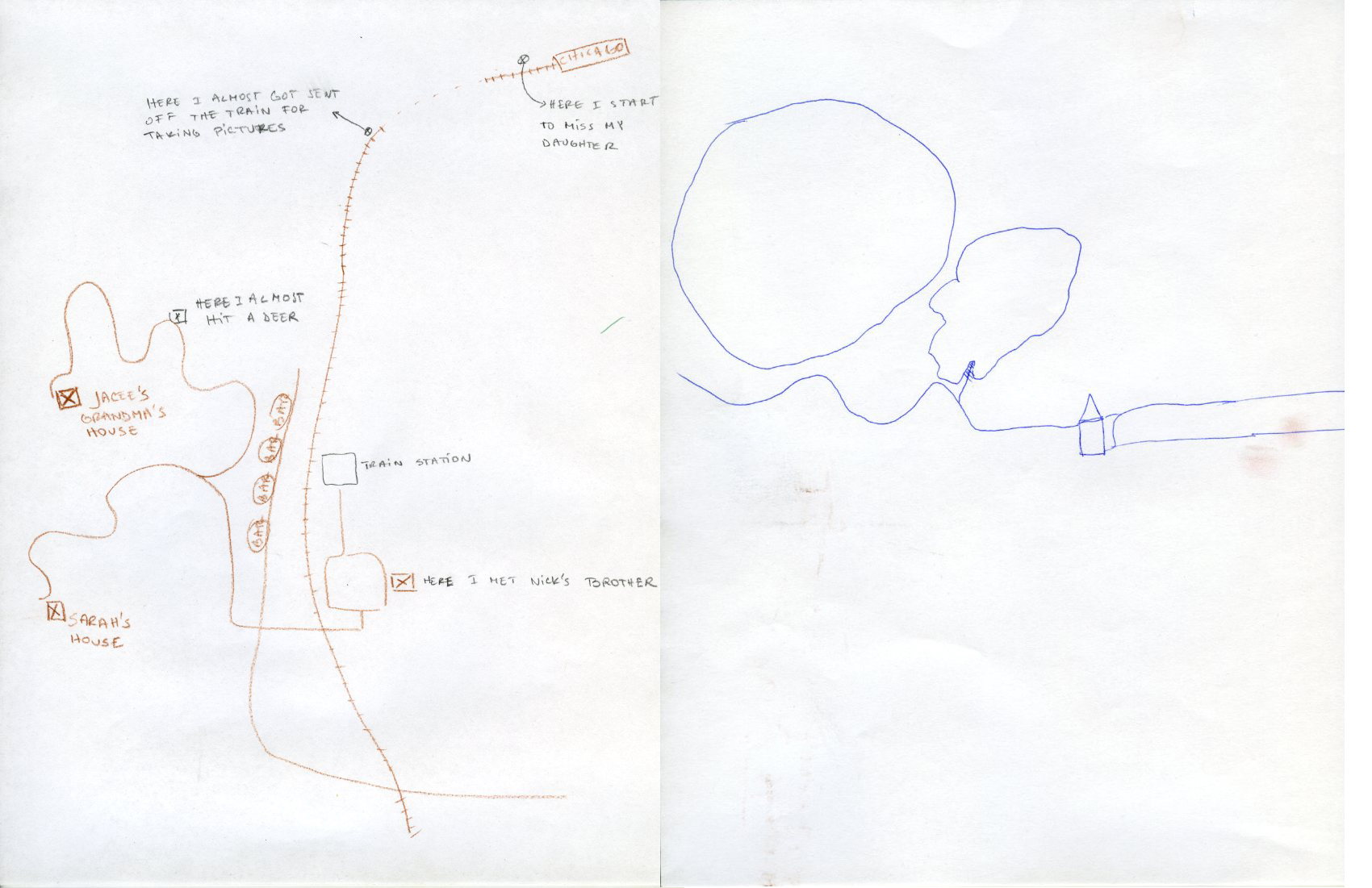
The workshop consisted of two approaches to spontaneous map-making; first reflecting an individual’s knowledge and familiar spaces, and then the aggregative knowledge of a collective. The first exercise was a ten-minute “warm up” for which, with pens and sharpies, people were asked to draw a map of the campus, or in practice, the crossroads of Carbondale. Each person drew their own map, and then explained it to the others. We noted similarities (horizontal and vertical transportation corridor lines) and differences. Even among those from the area, maps varied, highlighting different features; prisons, corn, the railroad and rivers. And people had different ways of narrating their maps, bringing to the fore the way maps are described, or told. In this context mapmaking is less an assertion of power and more an exercise in remembering and explaining the affective and familiar places that are part of the life of the storyteller. In storytelling, the dimension of time that is concealed by the map’s flatness or two-dimensionality is restored, at least within the representation of these places. This exercise makes intuitive the idea of a cartography with one’s feet, or perhaps a geography related to ones own corpus or body.

a local map of the familiar in Carbondale and Murphysboro, IL
Jan Fiorino’s map began with the Big Muddy River as an arterial, and contrasted the way others used roads to schematize space. Her map suggests a different world than one sees by driving down the road. Two more local, familiar maps are below.
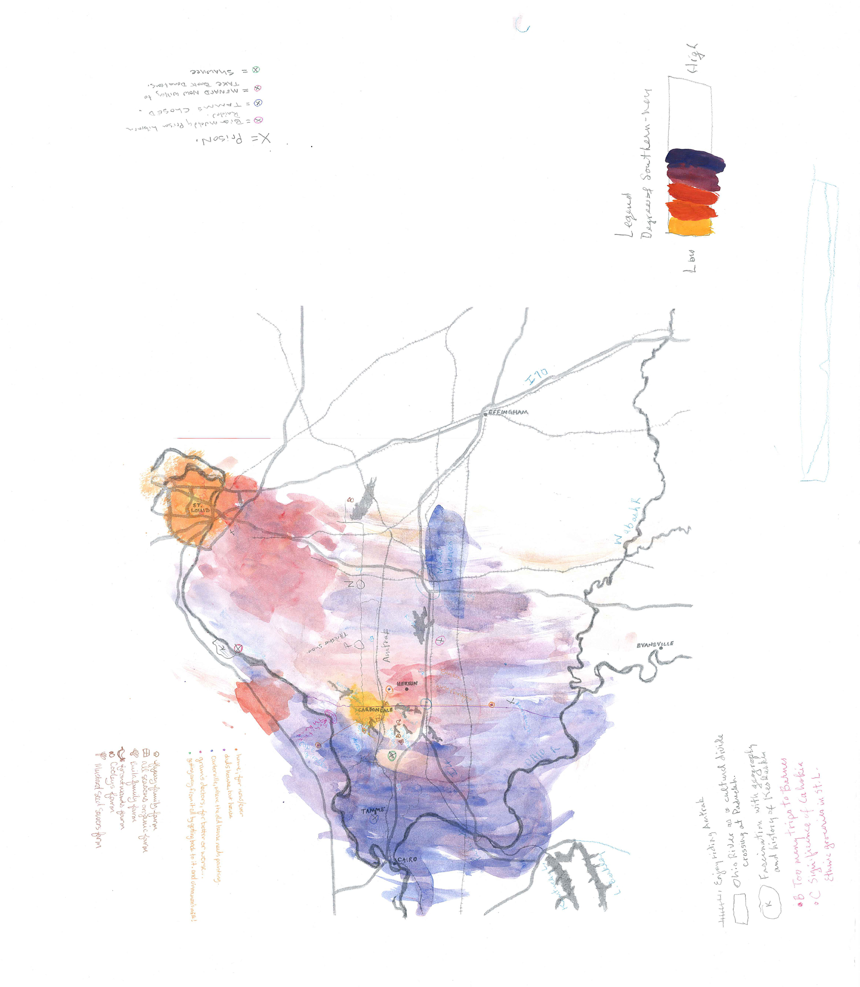
For the second exercise, we broke into three groups, and pulled out large-sized base maps of Southern Illinois, and materials to draw, paint and mark with. We offered suggestions for key colors and styles of cartographic marking, to expand the ways region might be imagined. The initial idea was that each group would be limited one method of marking, but this constriction collapsed as people were excited to use all the materials available.
Still these rules were generally followed:
(Points) Rumors (to be depicted in a color range of reds to blues that corresponded with the relative intimacy of this knowledge. The scale of intimacy ran from personal knowledge (red) to familial (reddish purple) or regional knowledge (purple) to universal knowledge (blue). Coalmining areas might be rumored universal, while the grave of a grandparent who died of black lung would be familial knowledge.
click to enlarge
The idea was to map things that one might have heard that happened within the boundaries of this map for which there may or may not be objective evidence. What happened, where did it happen? Prompts included locations of rumored activities corresponding to:
- sexuality
- the work-place
- criminality
- religious customs
- ethnic stereotypes
- toxicity, fertility, etc.

From total ignorance to “got it”. Key from group map- click to enlarge
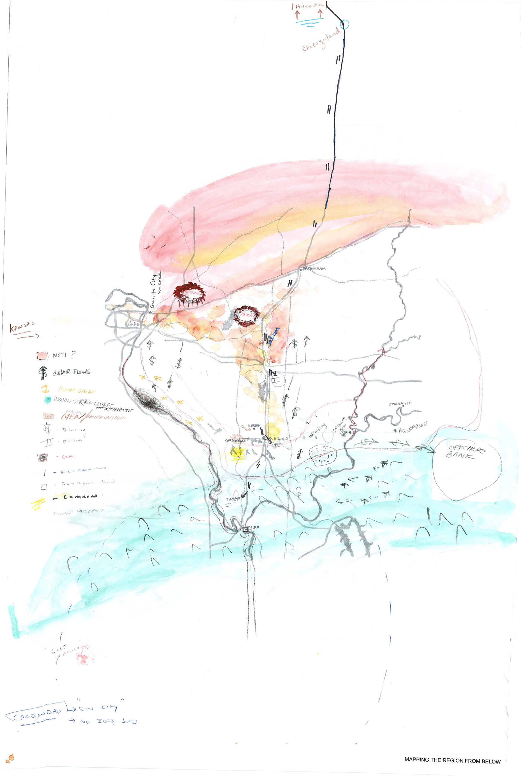
(Planes and washes) Biological fields and flows
Using watercolor washes, the goal is to depict ecological and social terrains map biological fields and flows. These might include natural terrains, those marked by agriculture, ethnic or economic populations, and regional atmospheres. Possible prompts with the watercolors were to indicate on the map terrains related to:
- land forms (hills, valleys, plateaus, watersheds . . .)
- migrations of birds, beasts, fish, insects, people and other biological entities
- agricultural & industrial activities (crops, urban and suburban environments . . .)
- racial/ethnic populations
- political affiliations, etc.
(Lines) Economic and political, corridors, circuits and sites of exchange
Lines will accumulatively demarcate public knowledge about the boundaries and vectors that result from the movements & barricades that organize the production and consumption of commodities, labor, cultural capital, etc.
- sites of labor and leisure
- the routes traveled by commodities, laborers, natural resources
- boundary lines that demarcate social/political affiliations (urban/rural, white/black/brown/Indian, state borders, etc.)
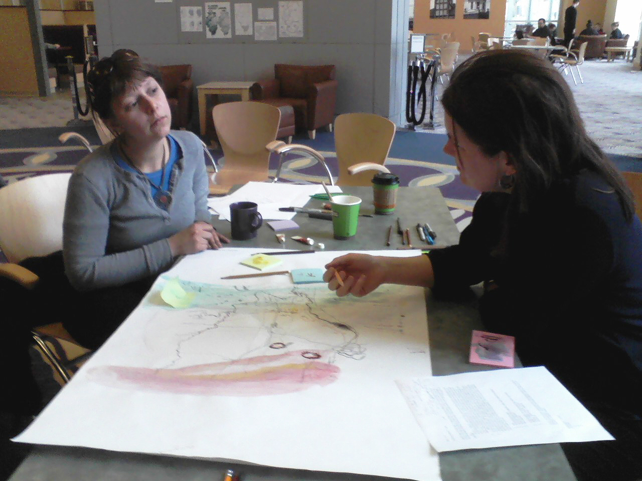
Each group worked together with watercolors, brushes, markers, colored pencils, straight edges to generate- perhaps to discover what was public knowledge, making this again, an opportunity to tell stories and ask questions. My group included a geologist who had worked in the coal industry and a grad student in philosophy; our negotiations were interesting. The resulting maps were full of many kinds of information and tales, and the dynamics of the groups themselves became folded into the explanations of how their maps came about and what different markings signified. Because people became so involved with what they were discovering from each other and their aggregative work, the workshop ended with a charge.
A map of the region from below: southern illinois made in the workshop “where you at”
Reflecting as I post these maps , it occurs how hugely, and deceptively the political boundaries of the state figure. It would be worthwhile to take these maps back out and build more layers on top of them, so as examine better the x-border flows.
Where you at workshop, group map. click to enlarge.